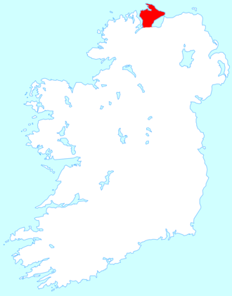
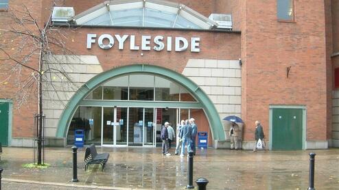
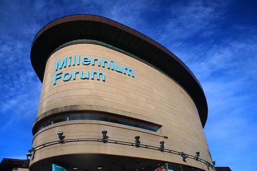
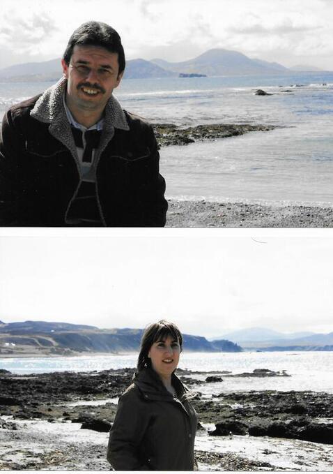
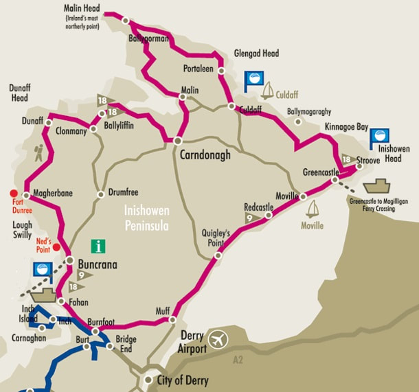
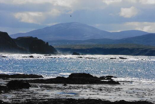
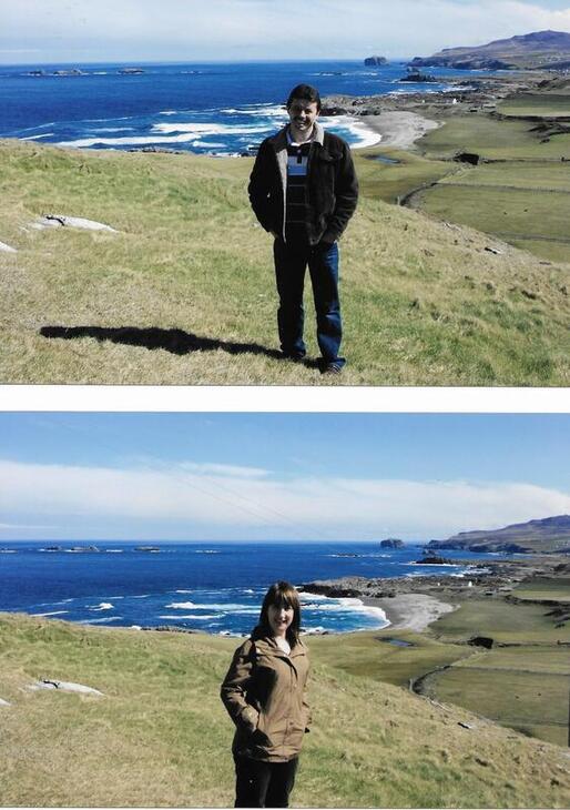
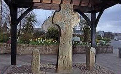
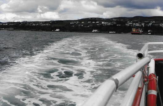
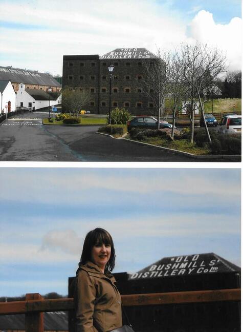
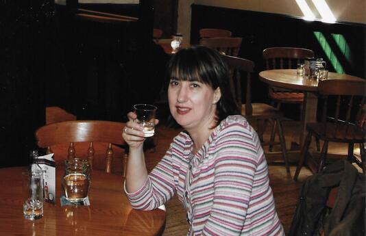
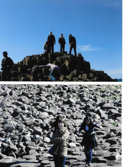
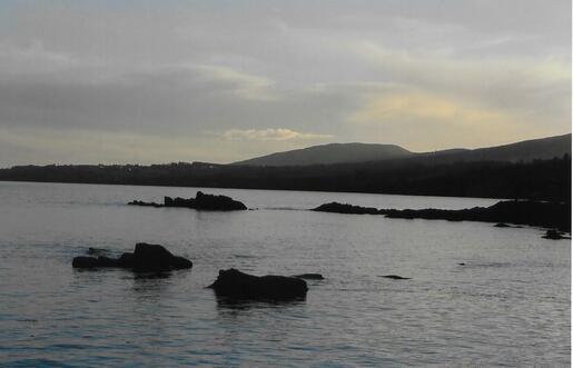
Our 2008 trip to "the forgotten county" & Northern IrelandMy mam, Peggy had “The Hills of Donegal” as one of her party pieces. On each occasion I’d hear her lilt "Oh Donegal the pride of all" about an exile’s pain and living in the hope of seeing those hills again …but I had never been to see those hills. Donegal in the North West of Ireland is probably the furthest you can travel from my homeplace in South Tipperary while still remaining on the island of Ireland. So finally in 2008 and 2010 I got to see this gorgeous county – first the North West of the County covering the Inishowen Peninsula venturing also into Northern Ireland in 2008 ….and then to the South East of the County covering Donegal Town, Killybegs and Slieve League in 2010. This week’s blog covers the 2008 visit. Enjoy! Thursday 10 April 2008 – Derry City, Co. Derry (NI) and Moville, Co. Donegal (ROI) Now I know what you’re thinking – sure Derry is in Northern Ireland and not in Donegal at all…..but Derry actually acts as a gateway in many respects to the Inishowen Peninsula. We took a morning flight to Derry airport from Dublin and hired a car for our four day stay from the Europcar desk at the airport. We would be spending the three nights in Moville but took the opportunity of seeing a bit of nearby Derry City. Of course that city has since been made famous by “Derry Girls”. City Walls You just can’t visit Derry without walking around the City Walls! They reveal a splendid city crammed full of history, heritage and interest. This is the only remaining completely walled city in Ireland and one of the finest examples of Walled Cities in Europe. The Walls were built during the period 1613-1618 by the honourable, the Irish Society as defences for early seventeenth century settlers from England and Scotland. The Walls, which are approximately 1.5km in circumference, form a walkway around the inner city and provide a unique promenade to view the layout of the original town which still preserves its Renaissance Style street plan to this day. The four original gates to the Walled City are Bishop’s Gate, Ferryquay Gate, Butcher Gate and Shipquay Gate. Three further gates were added - magazine Gate, Castle Gate and New Gate. Foyleside Shopping Centre Foyleside Shopping Centre is the North West's Premier Shopping experience with over 50 stores including M&S, Dunnes, River Island, Next and H&M and 1,500 carparking spaces. Back in 2008, it was a lot cheaper to buy clothes etc. in “the North” so we took the opportunity to shop in Next and Debenhams. Millennium Forum We also took in a children’s pantomime in the Forum which was the only show on that weekend there. It was a bit crazy being surrounded by hundreds of tots shouting “look behind you” but at least we got to experience the place!! Moville We were glad to make it to Moville to our hotel where we had dinner and then took some photos outside of the phenomenal views of Lough Foyle: Friday 11 April 2008 – Inishowen 100The Wild Atlantic Way, for the most part, follows the formally established route named the “Inishowen 100” coastal scenic drive. “The Inishowen 100” may sound like a Formula One race, but it gets its name from the approximate distance in miles of the sign-posted circuit, which starts in Newtoncunningham on the Inishowen Peninsula. However, as we were staying in Moville this is where we started and decided to head North in an anti-clockwise direction and do roughly half of the “Inishowen 100”; weather and time permitting. We particularly wanted to see Malin Head - the most northerly point in Ireland. The route was established originally as an independent traveller’s route aimed at walking, cycling or driving with special interest areas highlighted, that might otherwise have been missed. The “Wild Atlantic Way” (WAW) route must accommodate for large coaches (56 seats) to pass and park, which necessitates bypassing some of the minor roads. Therefore, the smaller groups and independent travellers following the “Inishowen 100” drive can experience that little bit more than those keeping to the designated WAW route. You will certainly not wish to break any speed records as you linger and savour the many scenic and historical gems that Inishowen, Ireland’s largest peninsula, has to offer. Moville A busy scenic market town, located along the banks of Lough Foyle. Moville also boasts having the ancestral home, called New Park House, of Field-Marshal Montgomery of North Africa and El Alamein fame. To further emphasise this link, overlooking the shorefront is a row of wonderful Victorian houses built in 1884 and named Montgomery Terrace. These houses have all been tastefully restored to their former glory. Greencastle This is a popular resort with a fine beach. It is an important commercial fishing port. It was once a place of historical importance. Richard de Burg (often Latinised as Richard de Burgo), the Red Earl of Ulster, selected the place as a site for a castle to dominate the O’Donnells and the O’Dohertys of Inishowen. This village has been synonymous with the sea for centuries and many generations of its people have sailed the seven seas. It is therefore only fitting that there is a Maritime Museum and Planetarium, with hundreds of relics of the sea, situated here, along with the Irish National Fisheries School, which prepares young men and women for a life at sea both practically and academically. During the summer months, a ferry crosses the Foyle to the Causeway Coast – it links Greencastle with Magilligan Point: both popular seaside locations. And we decided that as it was so easy to do we would do this the next day and so take in Bushmills and the Giant’s Causeway in Northern Ireland across the border. Stroove A favourite walk in Stroove (known locally as Shroove) leads to Port-a-doris – Port of the Door. The “Door” to the lovely cave is a natural arch. Here is a wishing well, where those who drink the water are said to have their wishes granted. Near Stroove, there is an ancient cross-inscribed pillar stone and a small modern cross. A spring dedicated to St. Colmcille spouts near the stone. The saint is said to have stopped here for water on his way to Iona. The area located close to Inishowen Head has many lovely small coves including a beautiful sandy beach known as “The Big White Bay” overlooked by Shroove Lighthouse which also has a European Blue Flag award and with the standards that apply to this type of accreditation, it ensures that this beach is also an excellent place for bathing. Kinnagoe Bay The scenery as you approach this beautiful cove is breathtaking. When you descend to the beach you feel as if you are in another world, totally cut off by the sea in front and the sheer cliffs to every side. Glenagivney, called the “Queen of the Inishowen Glens”, runs inland from Kinnagoe Bay towards Lecamy. It was also just off Kinnagoe Bay in 1970/71 that divers found the Spanish Armed Transporter, La Trinidad Valencera, a 1,100 ton wooden ship, which, badly damaged in a storm, had limped into anchor offshore on September 14th 1588 and sank two days later. Culdaff This picturesque village has two fine stone bridges and a triangular green featuring a now disused pump house. In Culdaff River you can see St. Boden’s ‘Boat’, a stone in which he is said to have crossed from Scotland. Only the sceptic will doubt the marks of his fingers! Situated on a pretty estuary, the beautiful sandy beach has attained Blue Flag status. Culdaff is a fine walking area with cliff scenery stretching North-West to Malin Head and Southwards to Inishowen Head. Glengad For generations Glengad has been a traditional fishing area, a practice still continued today. At Glengad, the visitor can take in views of Inishtrahull, Rathlin Island and further out to sea to the Western Isles of Scotland. Incidentally, two of the apartment blocks in my complex in Dublin are called after Inishtrahull and Rathlin O’Birne lighthouses …the naming theme being Irish sea areas and lighthouses. Malin Head Malin Head. It is not just Ireland’s most northerly point, but an area of great scenic beauty and of historical, scientific and ecological importance. The circuit of the Head will take you past the Radio Station, built in 1910, and round the coast to Banba’s Crown, the northern tip of Ireland. Here a tall derelict building known locally as “The Tower” was built in 1805 by the British Admiralty to defend against a possible French invasion during the Napoleonic wars. It was later used as a Lloyds Signal Station. During the Second World War, the small huts were built and used by our defence forces to keep a lookout and protect our neutrality. It is a perfect starting point for a ramble along the cliffs to Hell’s Hole, a remarkable subterranean cavern 250 feet long and 8 feet wide. Nearby is a picturesque natural arch called the Devil’s Bridge. (Above) Charlie visits Malin Head weather station and not a Milky Bar to be found!As children, Charlie and I were always fascinated with the weather forecast on the radio each morning that used to mention the Millibars (of atmospheric pressure) at Malin Head. Met Eireann have a weather station here. On his way to school Charlie used to dream about “the place with all those Milky Bars”! While we were disappointed to not find any Milky Bars, we were anything but disappointed with Malin Head……the place is absolutely gorgeous! Malin Malin is an unspoilt 17th century plantation village picturesquely situated at the head of Trawbreaga Bay. A key feature on the approach to the town is the 10 arched stone bridge spanning the Ballyboe River. It is the second largest stone bridge in Ireland. The original triangular village green is still intact, planted with limes, sycamore and cherries, and recently with oaks to commemorate the O’Doherty clan. All round the village are signs of the care that has won it many awards in the National Tidy Towns competition, including the much coveted overall prize in 1970. The Church of Ireland parish church has a fine three state battlemented tower with square pinnacles. The Lagg Road from Malin Head takes the visitor along the shores of Trawbreaga Bay. The Bay is an area of regional ornithological importance and has been declared a wildlife sanctuary. On a clear day Tory Island can be seen to the west and to the north lies the fine sandy beach known as the “Five Fingers Strand” backed by some of the highest sand dunes, of their type, in Europe. Carndonagh The chief glory of this market town is the famous St. Patrick’s Cross. Dated to the 7th century, it is one of the very early Christian crosses outside mainland Europe. The cross is 11ft. 6 inches in height and is regarded as one of the finest examples in Ireland of low relief carving. Alongside the cross are two pillar stones each carved on all sides. The most impressive sight to greet the visitor is the magnificent granite-built Sacred Heart Church, which towers above the town centre where four roads from the main compass points meet. Every single stone for this magnificent building was hand-carved and laid by Master Stone Masons from all over Ireland. At that stage we left to official Inishowen 100 and crossed the mountain to Quigley’s Point. We had no sat nav as we had no signal…but really enjoyed the journey as the scenery was amazing. Quigley’s Point Located on the Eastern shore of the Inishowen peninsula, overlooking Lough Foyle at its widest point. Quigley’s Point lies on the main road between Moville and Derry City and we had passed it on the way to the hotel the previous day. The village of Quigley’s point is also known as ‘Carrowkeel’ as it is marked as such on Irish Ordnance Survey maps. However all local signage and local post office give the name Quigley’s Point to the village. Redcastle Ancient maps show two prominent castles along the banks of Lough Foyle, one of Redcastle, which was then called Caire MacEwlyn, and the second at Whitecastle, once called Garnagall. Both castles belonged to the Clan Mc Laughlin. Sadly, nothing remains of these castles today. We arrived back in Moville ready for dinner! We had thoroughly enjoyed the day and had been really lucky with the weather! Sat. 12 April 2008 – Crossed into Northern Ireland (Foyle Rambler, Bushmills Distillery and Giant’s Causeway)Foyle Rambler Back in 2008 you could get the Foyle Rambler across the Lough from Greencastle (ROI) to Magilligan Point (NI). I understand that this is now run by Lough Foyle Ferry. The 10-minute journey on the 20 vehicle ferry was breath-taking! In busier times, tourists from the North, instead of passing through Derry city, used the Foyle Rambler to access 'land-bridge' routes across the Inishowen Peninsula to reach holiday-homes and popular seaside resorts throughout Co. Donegal. Old Bushmills Distillery From Magilligan we made our way in the hired car to the Old Bushmills Distillery. It only took a half hour to travel the 23 miles. This is an alcohol (primarily Irish whiskey) distillery in Bushmills, County Antrim, Northern Ireland, owned by Casa Cuervo. Bushmills Distillery uses water drawn from Saint Columb's Rill, which is a tributary of the River Bush. The distillery is a popular tourist attraction, with around 120,000 visitors per year. The world’s oldest legal distillery, Bushmills was first granted its whiskey-producing license back in 1608, though historical records suggest production began even earlier. Distillers used malted Irish barley, grains, and water from St. Columb’s Rill to produce their oak-aged Bushmills Original and their Black Bush blend. We got a tour of the distillery which was very informative. We then did the whiskey tasting…..you can tell from my face below that I’m not a whiskey drinker! Afterwards in the Gift Shop, I bought some Bushmill’s Original for my Dad and some fridge magnets as gifts. I also bought a fridge magnet for myself and still have it in my kitchen. Giant’s Causeway The spectacular Giant’s Causeway is only 2.5 miles from Old Bushmills Distillery so of course we had to visit. I had been here before (including a visit with my mam here). We took the opportunity again though to relearn the legend of Finn McCool and to walk in the footsteps of Giants while admiring this quite unique UNESCO World Heritage site. Sunday 13 April 2008 – Fly Back to DublinWe headed away from Moville refilling the car in Quigley’s Point before driving back down to Derry Airport where we handed the car back. Soon we were in the air flying back down to Dublin which took less than 20 minutes. It was a spectacular few days! And we vowed to return to "the hills of Donegal"! SOUTH DONEGAL TO FOLLOW… Bucket List Items Ticked Off in the above Blog 74 Number 34 - Eat/Drink Regional Food/DrinkNumber 36 - Food & Drink Number 60 (b) - Travel - Stay in each of the 32 Counties of Ireland
Other Blog Posts Blog 11 - Sydney, Australia Blog 12 - Hong Kong, China Blog 17 - Beijing, Xi'an & Shanghai, China Blog 19 - California, USA Blog 27 - Scotland Blog 28 - Barbados Blog 29 - Canada Blog 30 - Alaska Blog 31 - Everglades, Florida Have you ever been to Co. Donegal? Tell me about your experience in the comments section below. If you liked this post, please share. Sharing is caring 😊
0 Comments
Leave a Reply. |
AuthorMy name is Mary and this is my bucket list blog ...having survived a near-death experience. I hope it encourages you to "live your best life". See how I'm completing my own bucket list items. And let me know how you're getting on with yours! Archives
July 2024
Categories
All
|








 RSS Feed